More physically demanding than the uMngeni walk (though much shorter) this walk was far more depressing. I am quite sure the Lions River, on a percentage rating, is more impacted than the uMngeni on a kilometre to kilometre basis.
Sunday September 22nd dawned full of hope and promise as we headed for the source of the Lions River in the Fort Nottingham area. After half the walking team dropped out in the 24 hours prior to departure, it was wonderful to have Pandora, Mike & Stembiso to share the day with Preven & I – barring Pens, the entire team that started down the uMngeni River in May last year.
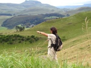
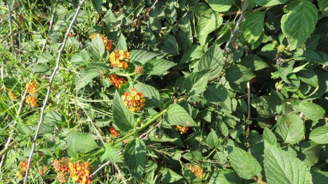
We spent a wonderful afternoon exploring the vast wetland hidden behind a slight ridge in the hills, and then our support crew Breandan and John drove back down the mountain to set up camp for the night whilst we followed the river – the Elands at this stage - and we followed the water course down from the wetland – dry for the first couple of hundred metres as the stream runs underground. Small sink holes appeared regularly in the grassland, until at last the crystal clear water bubbled to the surface. Tumbling through the grasslands, dotted with yellow Helichrysum, white Ericas, verdant green patches of moss , Gerbera (relative to the Barberton daisy), grass orchids and wild Irisis. Then the stream dropped suddenly over a small cascade, and mountain pools were dotted between clear rapids, and patches of indigenous forest clinging to the steep sides of the valley with gnarled Yellowwoods in the ravine and Proteas on the steep grassy slopes above.
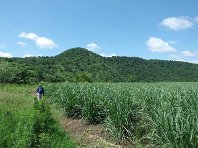
We headed up a side stream to our nights camp, and after an evening under the stars set off the next morning, our hearts singing, full of hope. Back down the tributary, down the main river and then only 4 kilometres from the source, with barely time to get into the routine of data recording and walking, the impacts began. Pastures – with wattle, bramble and bug weed on the river banks. Soon followed by a dam showing signs of nutrient overload, and the mini sass, some 5 kilometres from the source came up with a low score of only 4.6 (very poor condition – critically modified). Possibly due to the impact of the dam just upstream. After a pretty stretch, a land owner has been clearing wattle from the river banks (well meaning but logs dropped into the stream causing a mess of log jams, & scorched earth – piles of wood stacked and burnt which sterilised the soil) we passed peaceful pastures, indigenous vegetation beside the stream banks, the occasional drainage ditch. From then on things went from bad to worse. Dairy effluent turned the stream stinking brown with algae and aquatic plants proliferating.
We fought our way through thick indigenous forest to get round an extensive wetland on the opposite side of the river. A wetland laced with drainage ditches, cattle paths, eroded in places, but still vast in places. This was to set the scene for the next few days. In order to avoid the wetlands, we would fight through thick bush, climb steep hills, cross over 70 fences (or roll under them, or swing round them over the river….). Most of the time the river has formed a vertical sided deep channel, so the opportunity to do mini sass was limited, as was the opportunity to cross. Once on a certain side, there we stayed!
For the 1st three days we witnessed historical drainage ditches closed over with indigenous grass, newly opened drainage ditches of horrifying depth and width, dykes, timber right to the river banks. Along here only 1 more mini sass was done – with a score of 5.2 (Poor condition – largely modified). On the fourth day we realised that we were in a section of the river that was historically diverted – the river runs straight as an arrow across the old wetland (drained and planted to pasture). Kikuyu pastures and poplars line the banks. The river channel suddenly dropped over a waterfall on a small escarpment, and we hit the land of wattles, a dense jungle we had to hack our way through. Finally, after lunch on the 4th day, things started looking up – a few scattered houses with what a friend calls gentleman farmers (in other words just a few sheep, horses or cattle) – and the river began to look a wee bit healthier, with, for the first time, a lesser amount of sludge on the rocks. The mini sass score went up to 6.2 (Fair condition, moderately modified).